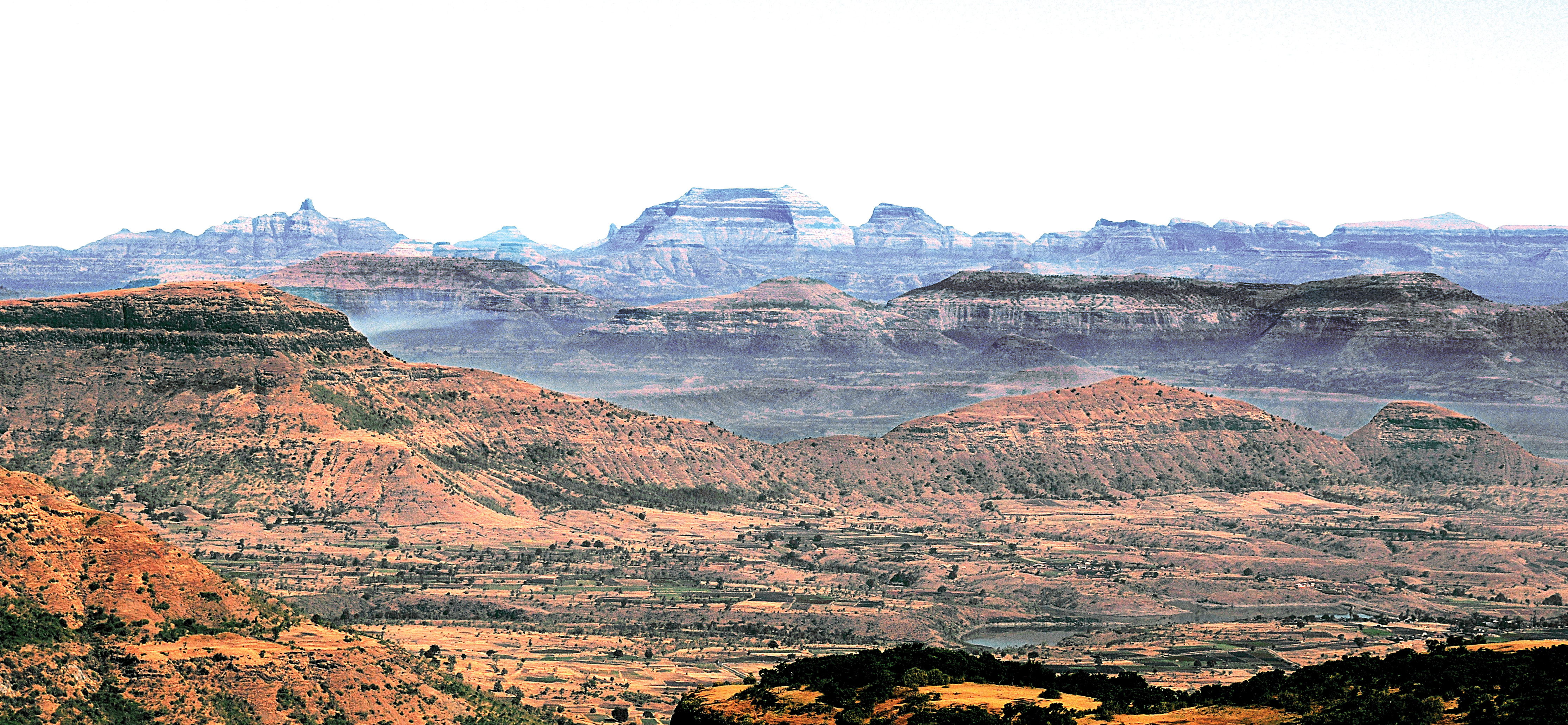
Selbari-Dolbari Range
Location Description
Selbari ranges are said to be the entry to the Sahyadris from the North. These ranges spread East-West out of which one is Selbari and the other is Dolbari. On the flat land of this region are seen tall mountains like a surprise element.
Salher (5140 ft. from M.S.L.) is the second highest mountain in this range. Buses are available from Taharabad to Salher from the Mulher route. Adjoining Salher is Salota. One has to approach Salher from the junction of these two. The entire panorama of 360º is beautifully seen from the top.
Mulher (4284 ft. from M.S.L.), Moragad (3970 ft. from M.S.L.), Hargad (4460 ft. from M.S.L.), Navhigad (4110 ft. from M.S.L.), Mangi–Tungi (4360 ft. from M.S.L.), are some of the important forts of his range. The village Mulher is right on the route of Satana– Pimpalner. Mulher is not at all a difficult fort to climb. The spread of Mulher is quite large and attached to it is Moragad. Hargad is also clearly visible from its top. It is also accessed from the same base village as Mulher. This fort is famous for the canon one finds on its top.
To reach Nhavigad from here, one has to travel from Bhilwad to Valkhed which is the base village. From the top the view of Mangi–Tungi is breathtaking. Mangi–Tungi is a famous religious destination of the Jain followers. The tall pinnacles of Mangi–Tungi and the connecting narrow ridge between them, are actually a wonder in itself. There are rockcut steps right up to the base of the pinnacles from the foothills making it easy to climb.
Crossing the connecting ridge is a thrilling experience.To the West of the Selbari-Dolbari range is the border of Gujarat state. The forts on this range near Gujarat were used to keep an eye on the activities of Dang and Baglan region in the historic times. The major occupation of the people of the region is farming.
The crystal clear water of Haranbari between these two ranges is very attractive. All the foothills of the forts on Selbari-Dolbari ranges are easily accessible due to a good road network.


