Baglan - Satana Range
Location Description
Baglan is a region on the Maharashtra - Gujarat Border. Satana lies in the same taluka of Baglan. While now a backwater, Baglan was once the site of the Baglan Kingdom, an Islamic sultanate that existed from 1308 to 1619. The native people in the area were the Bhils and the Konkanas.
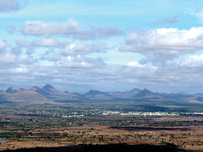
The Selbari range running to the West of Sahyadri range ends at Mangi–Tungi and Baglan – Satana range starts from here. The mountains run right up to Dhule region. In the Dhodeshwar region of Malegaon–Satana, are Dundha (2283 ft. from M.S.L.), Karha (2850ft. from M.S.L.), Ajmer (2854 ft. from M.S.L.), and Bistha (3140 ft. from M.S.L.), also known as Bijota. These not so tall forts are important from the historical point of view.They can be easily seen in a short span.
Dundha is well known for its rock cut caves and water tanks.
Continuing ahead in the range are Pisolgad (3339 ft. from M.S.L.), Dermaal (3529 ft.from M.S.L.), and Galna (1968 ft. from M.S.L.), Pisolgad has many historic remains of the structures which makes the trek worthwhile. Reaching Galna from Malegaon is very easy. This fort is the one that ranks the highest in the Nashik district for its remains of fortifications and bastions.
There are many religious places and temples in these regions like Dhodeshwar, Devlane which is flooded with the devotees throughout the year. The temples and natural sights are majorly of tourist attractions. Apart from this, the famous chocolate and sugar factories at Ravalgaon are also worth visiting. Along with the hills can be seen the fort of Bhuikot at Malegaon.
This region being in the close vicinity of Gujarat is very much affected by the culture and life style. This region is mainly mountainous. The main crop is pulses and sugarcane. The forest cover of this region is quite large.
Though being close to Sahyadris and Satpuda, this region is very harsh and dry in summers. Monsoons and winters are the best time to go for the trek in this region.