Pattya Range
Location Description
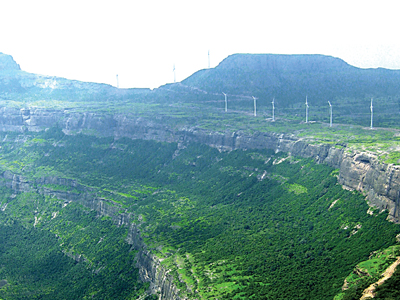
Pattya range is the range in Ahmednagar district near Akole. This place holds signifIcant contribution and history and geography of Maharashtra. The climate in the district is mostly hot and dry. It becomes cooler towards the western mountain region. The difference between the maximum and minimum temperature of the day is noteworthy. Rainfall decreases from western to the Eastern part.
There is dense forest in these ranges. The main mountain range to the West of Ahmednagar is known as the Harishchandra range. The central and Northern parts of the district constitute the Balaghat plateau. The Southern part of the district lies in the basins of rivers Ghod, Bhima and Seena.
Mahankaal (4682 ft. from M.S.L.), is known for the mesmerising views it offers. It is assumed that the fort must have been a part of the Swarajya, during the reign of Chattrapati Shivaji Maharaj. Bitangad (3560 ft. from M.S.L.), is a fort right next to Mahankaal and can be accessed from the same col as Mahankaal. This pyramid shaped hill has witnessed many events of the Maratha and Mughal enmity during the times of history. Pattya (4562 ft. from M.S.L.), fort is rich in the heritage of the historic structures it has on the top. The fort is also known as Vishramgad and it is said that Shivaji Maharaj rested at this fort after his battle at Jalna. Aundha fort (4629 ft. from M.S.L.), lies to the North of Patta. The sheer thrill of trekking can be experienced here since climbing equipments and techniques are required to reach the top of the fort. Mhasoba–Chennagiri (4178 ft. from M.S.L.), is a small hill on the route to Aundha and Aad fort (4046 ft. from M.S.L.). This place is famous for its religious significance as devotees come to visit this place from long distances.
Duberagad (2624 ft. from M.S.L.), Songad (2600 ft. from M.S.L.), and Parvatgad (2795 ft. from M.S.L.), are other forts on this range. Songad is a fort which shows ancient architecture reflecting both Maratha and Mughal influence.