Tringalwadi Fort
Location Type
Hill Fort
Best season
All
Distance from nashik
60 K.M.
Trekking facts
Way:
1) Towards West from Tringalwadi, along the path from the South of the dam. 2) An alternative way from Igatpuri.
Time To Climb :
2 hours / half day trek
Difficulty Level:
easy
Spread:
Medium
Water Availability:
Drinking water not available at the fort.
Carry Along:
No specific equipments.
Guide:
Available at Tringalwadi.
How to reach
NASHIK to Tringalwadi Fort
Reach By Car:
Convenient by car. Rent a car facility available from Ghoti, Nashik, Igatpuri.
Reach By Bus:
Buses available from Nashik, Ghoti and Igatpuri.
Reach By Train:
Trains available up to Igatpuri.
By Boat:
No boat route.
Facilities available

Accommodation

Food

Garage

Medical aid

Near By Places

Petrol Pump

Shelter

Souvenir
Location Details
The victory over the fort of Salher made the Marathas achieve their ultimate goal. In the excitement of winning it, they started conquering each and every fort in the region to increase their territory. At that time, Tringalwadi was also one of such forts. Then in 1688 A.D., the Mughal king Matbar Khan surrounded this fort. And in February 1689 A.D., this fort slipped away from the hands of the Marathas to the Mughals. After reaching the top, there is Kalsubai towards the East. Dhoria Mountain and Vaitarna dam is also seen at a far distance. The view of the Tringalwadi dam is breathtaking.
User Experience
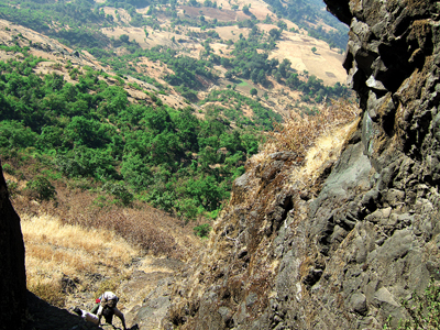
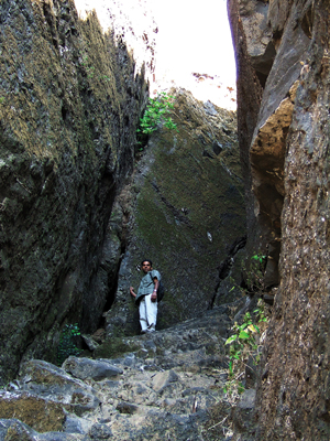
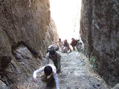
Pleasant atmosphere and the cool breeze makes every trekker visit this fort again. Being on the higher contoured area, it is very convenient for trekking even in the monsoons since there is no water logging here. In the monsoons the complete region has rice farms. After reaching Tringalwadi, starting from the west, one reaches the Tringalwadi dam in almost 10 minutes. The mountain range is in the form of the crescent and in the centre lays clear water of the dam. This dam makes the entire region very lively. While walking towards the South for the fort, one sees the blue water of the dam on one side while the lush green fields on the other. After reaching the foothills of the fort, are the Pandavleni caves towards the North. One finds beautiful stone carved architecture. Adjoining this is the way to the fort. On the way, there is a small cave towards the right. Then there are almost 52 steps carved in the rock. After climbing these one sees a stone carved statue of Lord Hanuman almost 8 to 10 feet tall. Here is an entrance gateway.
Do Not Miss
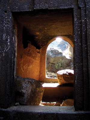
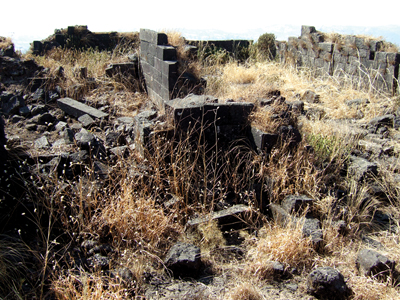
• Buddha and jain caves on East side. • Gautam Buddha idol. • Caves filled with water at intermediate level. • Remains of palace. • Dilapidated monuments. • Shiv temple on North side.
Add Trek Review
Ajit bachhav
First of all very useful app for our nature lovers..thank you sir..for such a wonderful app..
Nitinkumar Mundaware
Very pleasent atmosphere and really enjoyable trek
Gourang Ambulkar
This is a very pretty fort. The route to thw fort is also very scenic. From here one can see as far as Ghatandevi. Quick and easy trek. Swimmers can enjoy a cool swim in the dam at the base village.
Photo Gallery